
The SWM which started on June 5 has now completely withdrawn from all parts of India. A large subtropical high pressure has formed over Central India, signaling dry weather for most parts of the country in the days to come. A western disturbance persists over North Pakistan and its neighboring region which is expected to move eastwards bringing widespread heavy rainfall for the state of J& K and HP. Another disturbance persists in the Comorin Sea and its adjoining South TN which is likely to bring thunderstorms for South TN, coastal parts of Central TN and Kerala for the next 2 days. North TN will remain mostly dry with a chance of sporadic thundershowers in a few places of coastal region. Normally when SWM withdraws, North east monsoon (NEM) starts in a few days’ time, but this year there will be a delay in the onset of the NEM.


Chennai: Maximum temperature is likely to move closer to 34C. There could be some isolated showers during late night or early morning hours.
Coimbatore: City will see max temperature around 33C with a chance of rain during late night hours.
Madurai: City is expected to be partly cloudy with a chance of thunderstorm during evening/night. Temperature will be around 33C.
Vellore: City will remain dry with temperature hovering close to 33C.
Trichy: Temperature to be in 32-33C. Thunderstorms are expected in the evening hours.

When will be the exact onset of NEM 2015 . . Y It’s getting delaying and no more proper rainfall so far . . . . please tell me friends
27 oct onset. delaying due to wp ty koppu ;(
NEM set on 25 oct
gud morning blogerrs .why the bay is always clear nowadays without clouds when the clouds will form in the bay ?
Today rains possible in delta?
yes ji 😉
I think this year nem start Nov month
Waiting & waiting for nem & imd announced normal to excess rain in tn
yea hopefully this time it will not fail
OMG
Baguio city battered from koppu
815 mm rain in 24 hrs :O
Total storm total 945mm so far n its raining still but with lower intensity
so its impact is less thn wat we expected ?
?? 1metre of rain in two or three days..n u say its less impact
sry typo for more i typed less ;(
Lol dinakaran tamil daily say onset already started interpreting rains in STN as basis even saying it was confirmed by IMD
This is bad . They should not pull imd .
oh dont give much importance to vernakular dailies
They are one who provide news to entire TN it is read by crores of people.reach English is very minimal. It is another matter they best other than weather news
To be honest I do not trust even English dailies -it is not the reach alone that matters.We need to have authentic news and not hyped news. Tell me how my tamil magazine gives focussed/specialised news on weather
Pulling IMD for no reason has been in practice for many years now.
Redhills, Chennai along with Bloggers waiting for NEM – Pix Courtesy The New Indian Express
save this image it will be vry useful after NEM.
Dry weather going to persist in Chennai for Next 6-7days , After that , A bumper and super Nem onset possible . Record breaking November possible as per the models.
From 26th we can expect good rains!
no chance on 26th.
When are you expecting it Pradeep..
History on Delayed Monsoon from The Hindu
State receives excess rainfall in October
, IMD has forecast above normal rainfall (>111% of the long period average of 332.1 mm) during the northeast monsoon season for the south peninsula covering Tamil Nadu, coastal Andhra Pradesh, Rayalaseema, Kerala and south interior Karnataka. The peninsular region receives about 30 per cent of its annual rainfall during the northeast monsoon season from October to December. Tamil Nadu receives about 48 per cent of its annual rainfall during the season.
http://www.thehindu.com/news/cities/Thiruvananthapuram/state-receives-excess-rainfall-in-october/article7782630.ece
Assuming the onset date anywhere between 25-27, I’m still hopeful of 300-350 mm before this month end. We all are aware that NEMR is got from 4 or 5 spells of rains during the season spanning 3 to 5 days..
Lets take things as it pours..
sooooooooooooper , itha itha than naanum thirumba thirumba sollukiren and do not worry needlessly . Nature has reserved our quota for us in October
Boss 4 days of rains starting from ,say 27th has decent chance of giving us minimum 300 mm.
I will save this
you please save all the important comments and let us see how far they are accurate in their prediction. It will add more spice to prediction
Pls go ahead Kea.
25-27 not possible
Looking good!
Strong system expected around November last week as per CFS

Nowadays, lakshmi of hindu is not preferring kea bloggers. What happened.
Probably KEA is officially associated with DC
but newspapers should do objective reporting.
Better to stay away from media. From my experience they twist and report facts to their liking
DC is our frd
lot of convection near kerala coast.
South Tamil Nadu gets widespread rains, ending 8.30 am on 19.10.2015
=======================================
The cyclonic circulation extending upto 0.9 km a.s.l. over Comorin area and adjoining south Tamil Nadu persists.
in mm (min 20 mm)
Arantangi (Pudukkottai Dist) – 66
Tuticorin (Toothukudi Dist) – 64
Thoothukudi port (Toothukudi Dist) – 59
Gundar (Tirunelveli Dist) – 57
Mylaudy (Kanyakumari Dist) – 54
Shencottah (Tirunelveli Dist) – 53
Papanasam Dam (Tirunelveli Dist) – 52
Alankulam (Tirunelveli Dist) – 50
Lower Papanasam (Tirunelveli Dist) – 50
Kallupatti (Madurai Dist) – 48
Keelapavoor (Tirunelveli Dist) – 48
Manimutharu (Tirunelveli Dist) – 46
Chidambaram (Cuddalore Dist) – 43
Melaneelithanallur (Tirunelveli Dist) – 43
Kalugumalai (Toothukudi Dist) – 42
Rajakkamangalam (Kanyakumari Dist) – 41
Tiruvadanai (Ramanathapuram Dist) – 41
Kannadiyan (Tirunelveli Dist) – 41
Thenkasi (Tirunelveli Dist) – 40
Melur (Madurai Dist) – 40
Kulasekharam (Kanyakumari Dist) – 36
Sivakasi (Virudhunagar Dist) – 36
Kottaram (Kanyakumari Dist) – 35
Sankarankoil (Tirunelveli Dist) – 34
Tiruvarur (Tiruvarur Dist) – 32
Servalar (Tirunelveli Dist) – 32
Ayikudi (Tirunelveli Dist) – 30
Thiruthuraipoondi (Tiruvarur Dist) – 30
Cheranmahadevi (Tirunelveli Dist) – 30
Tiruchendur (Toothukudi Dist) – 30
Kuzhithurai (Kanyakumari Dist) – 30
Mullaikaraipatti (Tirunelveli Dist) – 28
Sethiathope (Cuddalore Dist) – 27
Annamalainagar (Cuddalore Dist) – 27
Vembakottai (Virudhunagar Dist) – 26
Kallikudi (Madurai Dist) – 26
Ambasamudram (Tirunelveli Dist) – 25
Bhuvanagiri (Cuddalore Dist) – 25
Lalapet (Cuddalore Dist) – 25
Pudukottai (Pudukkottai Dist) – 25
Radhapuram (Tirunelveli Dist) – 24
Nambiyaru (Tirunelveli Dist) – 23
Kulasekarapattinam (Toothukudi Dist) – 23
Ramnadhi Dam (Tirunelveli Dist) – 23
Bodinaickanur (Theni Dist) – 22
Kayalpattinam (Toothukudi Dist) – 22
Udangudi (Thoothukudi Dist) – 22
Thuckalay (Kanyakumari Dist) – 22
Colachel (Kanyakumari Dist) – 22
Sirkali (Nagapattinam Dist) – 21
Keelservai (Cuddalore Dist) – 21
Mandapam (Ramanathapuram Dist) – 21
Karaikal (Karaikal Dist) – 20
Mambazhathuriyaru (Kanyakumari Dist) – 20
Kothavachari (Cuddalore Dist) – 20
Palayamkottai (Tirunelveli Dist) – 20
Ottapadiram (Toothukudi Dist) – 20
Eraniel (Kanyakumari Dist) – 20
Anaikadangu (Kanyakumari Dist) – 20
Sholavandan (Madurai Dist) – 20
Eravangalar (Theni Dist) – 20
It seems TN will be having close to normal rain this oct eventhough NEM likely to happen only next week
eppadiyo mazhai vandha sari.
out of 438 mm we got 96 mm without NEM setting in.
May be another 1 or 2 cm if uac persists
Good morning. The upper air cyclonic circulation over comorin area & adjoining south Tamilnadu extending upto 0.9 km above mean sea level persists .
One or two places of south coastal Tamilnadu would have heavy rain.Some places of Interior Tamilnadu including Delta districts, western interior districts like Salem ,Erode, Namakkal ,Karur , Dindigul,Tirupur Krishnagiri and Dharmapuri would have medium to rather heavy rain for two days.Many places in south Tamilnadu would have heavy rain.
South of Chennai may have light shower and north east monsoon onset is delayed and vigorous rain expected in the oct month end.
The southwest monsoon has withdrawn from the entire country yesterday 19th october 2015 .
When will NEM set in meteorologist Senthil
I strongly feel NEM onset would happen on 28th oct followed by heavy rain for week time.
Expecting 220mm + for week time ..till 4th nov
220 in a week is not considered heavy.
220 in 2 days is heavy
Anything less than 550 mm in a week is not heavy
Posted in yesterday’s topic around 5 am.now I am repeating
NEM declared on 4th October 1999.How?
really?
You can’t set dates for the nature.
It is against their rule?
Yeah the nature takes it’s own course!
Then why some people say ‘Rules must be followed’,?
Rules are only for the humans!
Part’s of cloudy
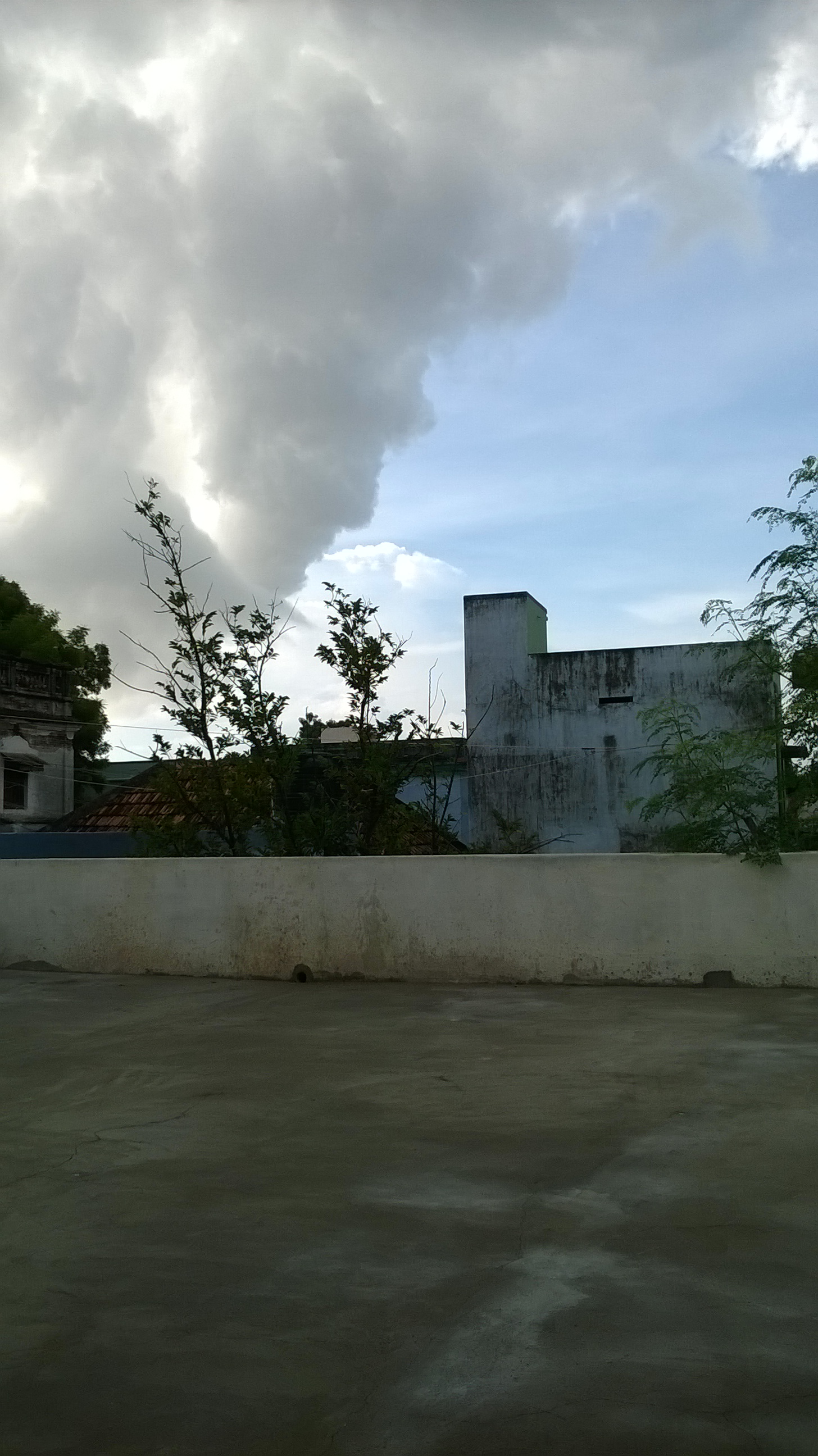
keep the phone horizontally to get a big view!
superb snap!
Luzon cyclone has disappeared fastly.any chance for NEM to set in before 25th oct?
Mostly not.
btw it is still wandering there
Probably between 26 and 29.
Vela is missing in blog these days. Atleast not as active like before.
He is still expecting 300 this October?
Vizag cyclone waring centre……said above normal rains for tamilnadu and costal andhra this nem
all are giving hope to us.
pandaga cheskuntham
JTWC has corrected the last 18 hours track positions of TY Koppu from it’s earlier marked positions. The last 3 positions have been moved a bit to the west , say about 30 km app. This shows that the system was indeed a bit offshore Luzon , rather than the previously marked skirting along the coast case. After its LF there has been severe disorganization to the convection, and was possibly because of the interaction with Luzon’s rugged terrain. And post crossing Luzon , it had been suffering a bit from the VWS , though being partially offset by dual channel outflow. There is also a suggestion that the shift of center is possibly due to some mid level feature. The following animation will clearly show the shift of deep convection to the western semi circle and also the clear demarcation of some mid level organization.
gfs predicts widespread hvy rainfall for coastal TN for continuous 7 days starting form 28th
its going to be non-stop pounding as per cfs with back to back systems 😮
nov 2nd week forecast
nov 13th
That cool breeze and fresh earthy smell of rain that herald the onset of the northeast monsoon may take a while coming to the city. The Meteorological Department has forecast that rain may be delayed by five-six days.
Monday was rather hot and sultry for October as the day temperature soared to 33.8 degree Celsius, two degrees above average for the season. Meteorologists attribute this to lack of moisture in the air. While the southwest monsoon completely withdrew on Monday, the conditions are not yet favourable for the northeast monsoon to set in.
According to met department officials, the monsoon normally sets in around October 20. Chennai may get light showers because of an upper air circulation in the Comorin area. “It is normal for the monsoon to be early or late by up to seven days. What is more important is the amount of rainfall it brings,” said S. R. Ramanan, director, Area Cyclone Warning Centre.
A typhoon in Philippines that made landfall on Saturday was a major reason behind the delay in the onset of monsoon, added officials.
K. Srikanth who blogs at Chennaiyil Oru Mazhaikalam said: “The typhoon that made landfall in Philippines has changed the wind pattern around Andaman Islands, which usually pushes moisture to the Tamil Nadu coast.”
Mr. Srikanth said weather factors like El-nino are likely to be favourable for the monsoon. Chennai has experienced above-average rainfall on nearly 70 per cent of the El-nino years from 1966. A recent El-nino year was 2006 when the city had excess rainfall by 32 per cent.
It is official now as Dr ramanan confirmed that delay in NEM and what is important amount of rain it brings rather than onset day
All forecasts are in line with mine, but only difference is they are saying Above Normal, but I said Excess NEM.
Fast moving low level clouds from NE. Pleasant morning.
Good morning everyone.
Just a week away from real NEM to begin😎
Get ready!!!
The South-West monsoon has exited the country 19 days after the normal date, an India Meteorological Department update said on Monday.
This clears the way for the North-East monsoon over the five Met subdivisions in the South of the country; but the onset has already been delayed beyond the normal May 15-20 timeline.
Surplus monsoon
The Met has forecast a surplus North-East monsoon during the October-December season this year with rainfall expected to be 11 per cent above the long-period average (33 cm).
The five Met subdivisions covered by the North-East monsoon are Tamil Nadu, Coastal Andhra Pradesh, Rayalaseema, Kerala ad South Interior Karnataka.
The seasonal rainfall for Tamil Nadu is most likely to be above normal 12 per cent above the long period average of 43.8 cm (base period being 1951-2000), the Met said.
The probability of an above normal North-East monsoon season rainfall over the South Peninsula and over Tamil Nadu is 88 per cent and 90 per cent respectively.
The five Met subdivisions receive about 30 per cent of its annual rainfall during the October-December season. Tamil Nadu in particular receives about 48 per cent of its annual rainfall during this period.
Riding El Nino
In this manner, the North-East monsoon is expected to ride the El Nino on the Pacific that has even in the past returned good rainfall for South Peninsular India without direct cause-effect relationship. The Met bulletin on Monday did not, however, say as to when the North-East monsoon would set in over Peninsular India.
What it did say was that the South-West Monsoon has withdrawn from remaining parts of East and Northeast India, Peninsular India, the Bay of Bengal and the Arabian Sea.
In recent years, its exit and the entry of the reverse monsoon (North-East monsoon) have taken place simultaneously.
This year, two raging typhoons (‘Koppu’ and ‘Champi’) in the Northwest Pacific have sent the wind flows over upstream Bay of Bengal into disarray, upsetting the Met applecart.
Winds in disarray
The winds are weak north easterlies over the Bay currently, but it will not be long before they are reversed to being south-westerly under the influence of the typhoons.
A welcome change is expected to happen around Monday when the south-westerlies flows turn around over the Gulf of Thailand to form a cyclonic circulation and reverses flows to being easterlies.
A couple of other circulations are also expected to form over the Northeast Bay of Bengal off Myanmar and also to the south-east of Sri Lanka, both of which are ideally positioned to trigger the North-East monsoon.
Under their influence, the rains may set in over Sri Lanka and adjoining south-east Tamil Nadu towards the end of the month, according to global forecasts.
But most of Tamil Nadu and the rest of adjoining peninsula, except Kerala, are expected to witness deficient rainfall right until the month-end,
Ecmwf picks a weak circulation close to tn on 28th..coastal tn shld get decent rainfall
Gfs picked it up first :p
haha
Lol…
ecmwf indicated it even in yesterday’s 00 Z run
Check sat’s gfs run u will see that circulation.. it’s far superior any day 😀
n ecmwf precip forecast is not that good
no…no.. it was expecting severe rain along cuddalore-nagai belt on 17th oct run..
Sellathu 😀
nambunga partner..
:D:D
Vittu tharardha illa…
both are equally good with gfs having slight edge
Yeah , both edge upon each other in some or the other
UAC?
marupadium uac ahhh .no ;(
nem uac ll do magic
apppahhh 😉
Why Bob is so dormant this Oct?
impact of neighbor basin
Now Shiva and Vela are the two expecting Chennai to get more than 300 MM this October. NEM onset happens on 28th. Nunga already got 84 MM, it has to score another 270 MM in last 4 days time.
Boss we can expect more than 300 mm
There is new is Tamil hindu “Heavy rain is expected tonight” in chennai is true?
See date!
No chance.
when it comes to weather news,dont ever follow news channels, except if it is a speech from imd people… our blog is 1000% accurate than tv channels
If it is written in Tamil daily, please make sure you don’t read that
well said.
sure
Clouds failed to give some rains after many attempts.
Looks like SWM onset over Kerala
http://www.imd.gov.in/section/satmet/dynamic/insatsector-ir.htm
The lower level analysis from the IMD GFS indicates the regions of net ascent and descent motions, which can be seen from the flow curvatures in the boxes above 15 N and 10 N to 10 S. The net precipitable water content that was increasing along TN coast and Comorin sea on the account of the UAC over the past 2-3 days is slowly moving westward and the effect of Indian lower level high pressure is getting down on the latitude slowly. The impact of TY Koppu is also quite evident on the flow changes happening near the Andaman Islands.
Whatever said by models for the past few days that is just happening now. We cannot ignore the models and go. Even though model says something, we can also think logically, even though we think logically we know that NEM onset is delayed. Hence we cannot ignore all the models just like that, there may changes in forecast from time to time but for some days it will be remaining constant.
Everything is happening as per their script.
mudiyala ..ethana script
Like Manirathnam movie, it should pour.
original script ..
yeah yeah..
What is the original script by the way 🙂
Real time data into modelling.
this is what we were saying right from the day 1.. neenga thaan “let’s forget the charts and expect the onset on 15th ne sonnenga”… :p
Athu summa pa, even i know by 04th October that it is not going to set by 15th.
I was very much disappointed on 04th after knowing it.
Model outputs ah nambunga boss…
nambinathunala than i was disappointed, actually i expected NEM to set by 15th until 04th Oct, since it is an ELNINO year SWM might withdraw faster, hence NEM will set by that time, but when i saw OLR forecast on 04th, MJO expected to set in Phase 1 by 20th only, then it comes to phase 2 by 25 or 26 oct, hence i came to know that NEM onset will get postpone after 20th.
U did not believe in the right models I guess. That has disappointed u .
But maisuh still doesn’t believe in charts 😦
He needs to come out of his views to explore other things as well. Just my opinion.
This hot bread has spread its size and intensity coinciding with w.pacific typhoons

What’s this??
last week upper level conditions ..
Check the pic…its wind anomalies
all are forcasting above normal rains for TN and some are forcasting excess rainfall including models and weather apps lets see wht nature can do with all the things he /she had. but i also feel NEM will not fail this time because there is elnino.week +veiod which is good for us (NTN/SAP).mjo at phase 2 .
Selva and GTS,
I still feel that NEM can be forecasted, I will not accept people say it is unpredictable. You guys also know that is possible, we just need to go in depth to analyse and forecast. The infra we have as KEA Bloggers it is tough. IMD can do it with perfection in future.
Partha, it is only about the present day skills and knowledge being lesser for NEM predictions as experts claim. It is not something that can never be predicted with good accuracy. Scientists are working on it and it is not so far that the success rate will increase. Unlearning and Relearning things is very common.
Whatever the technology we may have, i am not into it, but i am quiet against the concept of saying NEM is Unpredictable. I am sure it is Predictable.
the relationship which nem possess is liable to change every 5 year to 10 year. now if nem has good relationship with enso,it may change in next 5 years or the relationship weaken or even get reverse..and next 5 years iod relationship might strengthen.. like wise the variability happens with many other global index.. by the time we find a relationship monsoon might end.. most erratic in nature
instead of going by the events like ENSO or IOD we can go by the atmospheric averages of the month or previous month. Even IMD take the values of September and also Feb when giving LRF, i remember reading those in IMD page, but nowadays they are not saying it clearly.
If you say that ELNINO will bring NEM success then it is very generic statement, because ELNINO has failed the NEM too. Hence the atmospheric and oceanic conditions are not similar during same events. This is why i am saying that we should not predict NEM based on events, it should be analysed on the broader perspective. It can be achieved one day.
what decides the atmospheric averages.? it is enso ,iod and other index
it is not same and it differs every ENSO and IOD events.
haha.. yeah of course. but there will be some similarity.it differs bcos of one single event
Statistical significance should also go into considerations.
Can you eloborate on statistical significance? How is it done actually. What are all the things that go into getting it done , say for rainfall, co relationship etc..
Lots of cumulonimbus dense clouds seen to the west!
Upper Tropospheric Ridge runs between 10 and 15 N in the AS , and between 15 and 20N from Bob to SCS
A welcome change is expected to happen around Monday when the south-westerlies flows turn around over the
Gulf of Thailand to form a cyclonic circulation and reverses flows to being easterlies.
A couple of other circulations are also expected to form over the Northeast Bay of Bengal off
Myanmar and also to the south-east of Sri Lanka, both of which are ideally positioned to trigger the North-East monsoon.
Under their influence, the rains may set in over Sri Lanka and adjoining south-east Tamil Nadu towards the
end of the month, according to global forecasts.
But most of Tamil Nadu and the rest of adjoining peninsula, except Kerala, are expected to witness
deficient rainfall right until the month-end, these forecasts say.
http://www.thehindubusinessline.com/economy/agri-business/met-sees-surplus-reverse-monsoon-for-south/article7780942.ece
He mentions it as the withdrawal from the country has taken place after 19 days from normal, and has quoted IMD said so. I doubt on this, as the IMD charts itself keep the withdrawal line of SWM as only 15th Oct near 15N latitude.
The normal date of withdrawal from entire country is 15th October as per IMD. I too doubt this news.
At least he should not have quoted IMD, as I feel that might not have come from them.
Precisely.
agree there may be mistakes while reporting, but what i’m concentrated on this article is about the possible onset date of our nem,
Yeah , sure , I have been following his articles since my school days. His explanations have taught me many.
And also it is quite often , there comes a typo as May instead of October, I see this for the 2nd time
some parts of this article are repeating for the past 10 days or so, i’m also seeing this, may be like our IMD who are some times copy and paste the same reports with slight modifications, they are also doing this, i think so
If it is the case, I feel he should not do that. Proof reading could have been done.
I think the UAC over Comorin has moved to SE Arabian Sea, this is why more clouds developing in and around West Coast.
IMD forecast until 27th for TN is – Subdued Rainfall Activity to Continue over Peninsular India.
Going by this whether onset going to happen only on Nov1?
+/- 2 days
December 31st +/- 2 days
27/28 sureshot
Vizag: IMD assistant meteorologist for Hyderabad Centre, N Narasimha Rao, said the monsoon withdrew on October 19 this year as against October 18 last year. “The monsoon brought normal rainfall this year like in 2013. Last year (2014), the withdraw of southwest and onset of northeast monsoon happened simultaneously on October 18. However, this year the northeast monsoon is yet to hit south India. It will sweep across southern India by entering through south coastal AP and Rayalaseema,” Narasimha Rao told T.O.I
t.o.i
ELNINO has raised a wall.. we need to lookout for wave activity to change this scenario
I remember reading an article saying that conditions in Arabian Sea causes ELNINO, i dont remember how it is related, but what i say here is what i remember from that article.
I am searching for it, but not getting it, i am sure i will find it, will share once i find that article.
can u elaborate …? what conditions?
athathan sonnen, i dont remember, whatever i remember i have shared.
i am searching for that article.
What wall?
imaginary wall..not in reality.elnino favours arb sea round the season & suppress bay… it change only when wave activity moves in
Hmm
That kind of spin and churn near the 15 N lat in AS was well reflected in the water vapor animation, with dry air wrapping in from the WNW and moist air going in from ESE.
Rainfall in and around chennai till sep 30
Average – 543 mm
—————————————————————————————-
Poonthamalle – 702 mm
Poondi. – 618 mm
Meenambakkam – 571 mm
Tamaraipakkam ( avadi) – 551 mm
Red hills ( puzhal) – 542 mm
Cholavaram – 537 mm
Chembarambakkam – 518 mm
Nungambakkam ( city) – 430 mm
Tambaram – 419 mm
—————————————————————————————
26th October, something positive. But not for onset.
Atleast it’s possible on 28th
Good morning.
My outlook for NEM 2015
Onset date: 27 Oct
Oct: Not expecting more than 200 mm starting today
Nov : At least 500 mm. Don’t be surprised if we get more than 700 mm. A couple of systems possible.
Dec: Around 300 mm
This NEM will be surplus. No doubt about that. Late ah vandhalum latest ah Varum :p
27th ah. Where is the rains on 27th.
28th more likely
I forgot to add this :27/28 oct
its 27th only
27th confirmed?
official onset date may be on 29th
Nature is our boss.
why you are going for NEM 2025, 10 years to go
haha.. no one noticed it .. brilliant
where is 2025 mentioned in it….i dont understand
nem 25
Super fast forecast
India’s back-to-back drought is likely to end in winter with the weather department predicting higher-than-normal rainfall between October and December in the southern part of the country and normal rains in the rest, boosting prospects of the winter harvest.
The special forecast made jointly with the weather bureaus of eight South Asian countries comes as a relief after a near dry summer sent food prices spiralling and stoked rural distress. Poor winter rains could deepen the crisis.
“Normal to above normal rainfall is likely during the 2015 northeast monsoon season (October–December) over southern parts of South Asia including southeast peninsular India, Sri Lanka and Maldives. During the season, normal
to above normal temperatures are likely, over most parts of the region,” the consensus forecast says
http://www.hindustantimes.com/india/winter-monsoon-set-to-quench-southern-states/story-X4MaR7v0DPMLN5FzYXvynM.html
Omg then no winter
10th anniversary of hurricane wilma.. record breaking hurricane in the atlantic history

Sel and GTS,
One basic question, all oceans are same in terms of developing events like ELNINO and IOD?
U mean the state of oceans ?
the procedure..
Not getting ur point, can u please elaborate a little more ?
what causes ELNINO and IOD.
I guess it is not understood completely till date, though there are suggestions about oceanic waves kicking it off initially.
I think there is a difference in process between IO and Pacific.
That is still under a debate. There are supporters in the Scientific community who stand on either sides.
I dont think there is a debate, the more chlorophyll in IO is the reason for later reaction of IO to develop an IOD event and also the the Indonesian Through Flow, in both directions it can get affected.
no debate??.. maybe u have read only few researchpapers.. In next one year you will tell more than 8 reasons for iod formation and sst avriablity in indian ocean.. it is not the cause..it is the effect of iod and el nino effect.. phytoplanktons,chlorophyll,fish population gets driven by the variability of sst .not vice versa
Exactly , i was about to type him ,that it is not the cause , but the effect.
I agree with you on Chlorophyll and Phytoplanktons are the reasons, i know i read that too, but does it nor differ from the process of Pacific-ELNINO and IO-IOD?
This is my question.
what is the process u r asking ? surface or subsurface?
which causes ELNINO and IOD, surface or subsurface heating?
It cannot be attributed to just one component. It is a combo of many aspects.
oceanic conditions play a meaty role.. rest gets enhanced by intraseasonal oscillations and other atmospheric component
does Pacific and IO are similar in developing ENSO and IOD?
there may be some differences but the process would be similar .. are u asking whether the process is concurrent here and there?
SS, i feel that process difference is visible for me.
Date 26 is always dangerous… So onset deluge might possible
Rightly said i always believe in that.
Ettu athan
We have a feeling that whenever wind speed increases on a rainy day it becomes cold. Does the temp. drop in the air when it is windy ? Any guesses ?
Dont think the temp drops, have seen places where the air temperature is not that cold even on rainy days.
Exactly …
during monsoon time cloud temp will be lesser in comparing to cloud developed during summer.
the cloud temp will be more cooler during summer time as the condensation forms faster and deeper and when rain pours it cools the land faster, but during monsoon time the surface will be cooler always hence the condensation will be with lesser temp over the cloud and the rain coming out from that cloud is not helping the surface to cool further.
Wind blows from HPA to LPA area. Wind speed depend on the pressure differences between the high and low pressure systems. Fast winds often occur near LPA or Cold Fronts. Wind will be faster when it is blown through a narrow space. The strength of the Cold front formed between HPA and LPA decides the cooler temp in air.
OMG . Partha , u have gone deep into meteorological aspects.
now thailand meterology says the winds turns south westerly and rains are possible from south. but they said this condition would undergo a change within 24 hours. Andaman sea winds are at present still south westerly and so unless there is a change in the wind pattern, the moisture clouds may not reach the coastal areas of tamil nadu. But IMD is telling it would take further 7 days to change, which i think they are telling it more on the cautious side. i still feel rains would come back soon. – may be within 24 to 48 hours. let us hope for the best, as entire chennai city is totally dry after very hot days for the past 10 days. though we received some rains yesterday, it is of no use, as no water gone down to bore-wells
ss
Please don’t go to conclusions just based on momentary wind changes and patterns.
what is your say on commencement of rains. any specific date, can you predict based on your study.
ss
Rather to say as prediction , I would just say as my interpretation from my observation of models and charts. The rains may commence after 28th Oct .
28th means we will be missing most of the october rains. it is really unfortunate to loose nearly 40 centimeters of rain. too difficult to overcome the deficit. i think by january, the entire city needs to be evacuated due to water shortage. no one is taking any action to bring water. what a pity. But still nature can turn the tables. I am still not very much convinced with these models forecasts
SS
Delayed onset does not always go in with a deficit Monsoon. It all depends on the duration and frequency of active spells in the total season. October deficit is still a cause to worry, but it it can be balanced in Nov and Dec, it might end on a positive season for the region.
i recall chennai city received more than 100 centimeters in october 2005. by december first week normally the rain belt would shift below 10 north latitude. so chennai will be left high and dry. October is the real crucial month to give a grand start to end up well.
ss
Yes I agree on the benefit of Oct rains for Chennai latitude region. But apart from general southward movement of the ITCZ, systems can come out of the shell. But still if one goes by the forecast, the probability of S.TN getting the taste of excess is much higher than N.TN districts relatively.
SS,
Seems you are ringing the alam bells so soon…
Btw, 400 mm is excess rains for October as per the average rains ..
I will be contented even if we get around 250 to 300 mm by October 31st.
SS,
Seems you are ringing the alarm bells so soon…
Btw, 400 mm is excess rains for October as per the average rains ..
I will be contented even if we get around 250 to 300 mm by October 31st.
Madden-Julian Oscillation is forecast to strengthen
– Climate models are forecasting the Madden—Julian Oscillation (MJO) signal to strengthen and move over the Indian Ocean in the next two weeks
– With the MJO over the Indian Ocean for the coming fortnight, northern Australia can expect less rainfall
This is classical “Pull effect” …Kea was searching for Vela.. Here he comes..;) 🙂 🙂
I am here only…. Thala, due to involvement in new projects, i face difficult to find time towards blog…..
Tropical cyclone activity persists across Pacific Ocean
– Super typhoon Koppu made landfall on the Philippines causing significant damage
– A second typhoon, and a strong hurricane, are also currently over the Pacific Ocean
Pacific and Indian Oceans reinforcing dry conditions
– The combination of El Niño and a positive Indian Ocean Dipole typically leads to drier-than-average conditions across northern Australia
– The monsoon onset date is expected to be later than normal
Omg Pillur Dam records 145 mm, Bhavani dam can get more inflow. It seems a cloud burst has happened. Entire Erode District battered too. As usual kanyakumari dt record widespread rains.
PJ wants me to be positive this November. I don’t know how I can be even more positive. I have been expecting a very good NEM 2015 since start of NEM 2014 itself.
As October rains have failed to materialise, November automatically will be very very wet.
I want the background of your analysis, how can a Failed October can bring Good November, is there any on/off button?
If October & November fail how can 2015 be surplus as per my 2014 October predictions?
How do you day that October 2015 rains have failed. One LPa around GOM can give 300 mm in few days time. Better to keep the nails in your pocket rather than nailing it in the coffin so soon..
i think people are more against media, and it articles, exactly before 20 days, a report from business line quoted that U.S weather agency has forecasted, that India may receive S.W.M rains at least till mid october, and that what happened in real, when every one expected early on set of nem, i’m not fully support media, but there is no reason to go against them, we have to pick the content what is more apt, and should ignore others
Yes Sir , absolutely right. The opinions and information they bring to common people like me is a work to acknowledge. My only concern was that , I just kept myself in a situation currently as a school student or a beginner in looking at the weather. If that is the case, I may not be able to differentiate about correct and incorrect details. Errors do happen , and we may not just blame on the author for it. It comes out of many hands until it gets printed.
best is to stay away from media. That is my opinion.
pl, avoid sir,i think every one is matured enough to say what is right, or wrong, i think a student at the age of 7/8 have more knowledge than me, when we associate with media, whether it is print media or visual, i think it is not at all fair to go against them, of course every one have right to say their opinion, but what i’m thinking is whether we are going overboard, when criticize others, whether ii is against media, Imd, or any other things,
sorry if my comment hurts any one
Yeah agree with your opinion. It was just out of some curiosity I gave my opinion on the content in media, feeling that it could have been corrected at someone’s notice.
sorry, mine is general opinion, not against any one,
I feel ur opinion is wise, and please no sorry for that.
can any one clarify the north east monsoon winds impacted by west pacific ocean than bay of bengal, which is thousands of miles away.
SS.
A powerful typhoon can do a lot of damage to wind pattern even thousand of miles away.
SS, pls wait, GTS is preparing a reply. It would threadbare I guess…
Selva,
How can you say that Oceanic conditions are the base for any events?
I feel that the Atmospheric Anomalous Conditions are driving force for ENSO and IOD events.
partha, oceans kickstart and atmosphere maintains… soi is the atmospheric component of enso,you will not see soi in strong negative during cold phase of enso and strong positive during warm phase.
opinions differs.. its better to move
most of my research papers are originated from IRIDL-Columbia, i think this can be reliable to some extent than others.
From this i read whatever i said here about IOD, there is a process difference in IO and Pacific. Pacific can change faster than IO. The penetration of heat over sea water depends on the wind direction. If wind direction is condusive, then it is easy for sun rays to enter subsurface of the ocean and start to heat it, also the wind pattern will decide on the upwelling/downwelling process and also ignites the ocean current and this indirectly creates tropical waves and causes changes in weather pattern across the globe.
tat is the basic difference..our indian ocean is small,landlocked unlike pacific.. see the variability depends upon the sst, overlying circulation and with that conditions they trigger deep convection round the year.. entire process wont be same here
yes selva, this is the answer i wanted from you and gts, i heard someone saying that process is same across basins.
anyway lets move on to other topics, thanks for your and gts time.
NEM onset by 28th night or 29th morning.
The main reason for the cold feel that we have on windy conditions on a rainy day has to do with just simple heat transfer mechanisms. In actual , the temp. does not reduce with winds, but it is something to do with the heat transfers around our human body. Under calm winds, the heat that our body generates stays close to the skin and gets diluted gradually into the surrounding air. But , in th case of windy situations , that rate of heat generated from our body is slower relatively, that the rate at which the heat is removed from the skin by winds. This imbalance creates a feel in us that it is colder when the wind blows, and there is not much reduction in the air temperature actually.
nice explanation bro.
Thanks bro , just happened to learn it a few days ago , and thought of sharing it here.
Experienced this so times during monsoon days. In fact, we feel more cooler on rainy, windy conditions rather than the Winter itself.
Yes , the same feel Kalai, that kept me to look on that article.
That’s the wind chill!
Yeah bro, u would have better experiences in the U.S
Yeah the wind chill factor plays a huge role in colder temperatures.
Irupaa, irupaa. I’m reading it again…
Cool explanation. Thanks.
Water’s (sweat’s) latent heat of vapourisation is significant, hence the cooling effect on the surface from which it evaporates. Winds increase evaporation rate.
Yes exactly , that also keeps us cool in summer with humidity here.
Infact , the best event that I could relate is during the Oct end DD of 2005. It had rained that monstrous spell thru the night and early in the forenoon, remember one huge spell from around 8.30 and 9.30 am. After that , the rains reduced much in terms of intensity except for some light rains. I felt the real chillness from the cyclonic winds that swept in surges now and then in the afternoon hours. Actually , those days I used to look at the “HINDU’s” temp. readings of Chnai and Chnai AP that Skymet gives on the 3 rd page. The temp. it showed the next day was as MAX. 23 C and MIN. 23 C, Literally the temp. was almost constant, but felt the chillness when the winds swept.
Can you please post the snapshot of that Hindu Weather column incase if you have it?
Sorry Kalai , unfortunately I don’t have that historic day’s column.
Oh, its ok.
Kalai U can check 2005 Temperature Data in KEA Weather Summary
http://www.kea.metsite.com/summary/2005_10.txt
OCT 27,2005
Max – 22.7
Min – 19.3
Thanks! Will refer.
Same was the case on December 29th ,2014. Remember around 2pm it was just 22 degrees Celsius Max Temps. One of the best days in terms of the word “heavenly”.. in a city like Madras.
Yes Novak, December end and a day’s long rain event will the best ever heavenly weather.
I Remember during NOV 2011 Without Rains Night Temperature went down to 18.5’C
Next week looks awesome in moonsoon data

its still all in the sea
Lol Ehsan
what LOL, look closely
Obviously most of the rains during the NEM would be in the sea!
Oregon na chummavaa
During SWM too Most of the Rains Fell in Sea which will be very much higher then Rainfall Fell Over Inland
To me, this COLA chart is an absolute crap. People who love Paint Brush may like it though.
But based on gfs….
Relationship between Elnino and phytoplanktons
Elnino causes reduced upwelling, with warmer water and less phytoplankton and vice versa during lanina.
But apart from this, presence of phytoplanktons in sea have effects on sea surface temperature.
So it is not sure always which is the effect and which is the cause
MJO likely in phase 2 by 24th.
But why is moving ti
But why is moving towards phase 1?
it will change in the coming days.
Oh ok
The blue line from West indicates that MJO arrived in Phase 1 and the moisture will move towards us in the coming days. The positive phase of MJO in Bay will slowly move and ACC will move away from us after 24th.
Kelvin has moved into Phase 2 with strong amplitude. I think it will not lose its strength in Phase 3 also, forecast will change. If it does not lose its strength in Phase 3 then the IOD values will come down and also MJO will be stronger after 24th and into November.
So dhamaka rains guaranteed in November???
be careful, in Nov we will say dhum dhamaka in dec
OMG govinda govinda goovindaaa
Hope its not dandanakaa…
Aiyo ennama(NEM) ippadi panrenga maa
I posted this yesterday evening itself that mjo has entered Arabian sea
Jupi, even me..I had posted a year back that this guy MJO is wandering some where in the ocean waters.. Still not to be found. I’ve given a complaint to the Naval coast guard authorities. Expecting a WAP message soon from them.
:)…
you are right partha..magicseaweed model shows easterlies from gulf of siam entering into BOB by 24th earlier it was showing around 27..some speedy recovery happening
With so many interesting questions from Paartha to Zen/GTS..It surprises he doesn’t turn up for any of the official / unofficial meets or get together. Till date, he has kept himself away. Paartha, I’ve reserved a seat at TP exclusively for you with Arun ice cream Maharaja Kulfi n Srivaari Coffee. When are you coming..
Shiva,
I refrain myself from meetings due to unavoidable situation.
Noted. Chumm an inquiry..
Thanks for your invitation shiva, when you have meetings please call me from the location and i will talk to all of you even for hours.
Hours?? On my call or yours?
Btw..” Location” it’s all chatting n no shooting..
anyway you want.
OMG…it looks discussion going agai till today. It’s better to go through this link before blaming unnecessarily others. Please refers paragraph 2 first 3 lines (I can not copy and paste here those lines) which stating that “ocean currents constitutes climate/atmosphere of many regions on the earth”. Ocean currents are very important part of our earth atmosphere. https://en.m.wikipedia.org/wiki/Ocean_current
Surface oceanic currents are sometimes wind driven and develop their typical clockwise spirals in the northern hemisphere and counterclockwise rotation in the southern hemisphere because of imposed wind stresses
I never denied these points. Had I?? I told Ocean currents (under water & surface water) are very important, which constitutes atmosphere of the earth.
Upwelling/down welling mechanisms taking place due to combination of 2 factors 1) heat difference 2) earth coriolois force near equator (near equator) 3) adding 3 rd point difference in densities of water. These concepts are simple basic fundamental points, which no one here denying. It’s better to restrain others unnessay blaming others without going deeper into the mechanisms.
From that link : “An ocean current is a continuous, directed movement of seawater generated by forces acting upon this mean flow, such as breaking waves, wind, the Coriolis effect,cabbeling, temperature and salinity differences, “
Mr.parthasri.
I value your inputs, as i used to see lot of interesting study/observations in your mail.. R u confident that rains would commence only by 28th night. You go by what you derive out of models or you have your own model.
ss
I dont have my own models, neenga nalla kalaikareenga.
The point is i believe that we have to wait till 28th.
purely your guess or intution. still you have good knowledge in this subject. astrologically talking these are all period supposed to give rains. in fact from tomorrow evening to another fortnight, very good moon’s influence can trigger a good system in bay. let us wait and watch
ss
THE CHIEF AMOUNTS OF RAINFALL RECORDED IN
CENTIMETERS AT 0830 HOURS IST ON
20-10-2015
Colachel (Kanyakumari Dist) 7
Eraniel (Kanyakumari Dist) 6
Sathyamangalam (Erode Dist) 5
Mettupalayam (Coimbatore Dist), Kangeyam (Tiruppur Dist), Pudukottai (Pudukkottai Dist) 4 each
Bhavanisagar (Erode Dist), Attur (Salem Dist), Kumarapalayam (Namakkal Dist), Mylaudy (Kanyakumari Dist), Shencottah (Tirunelveli Dist), Chengam (Tiruvannamalai Dist), Coonoor pto (Nilgiris Dist), Coonoor (Nilgiris Dist), Sankaridurg (Salem Dist)
3 each
K bridge (Nilgiris Dist), Manimutharu (Tirunelveli Dist), Perundurai (Erode Dist), Thoothukudi port AWS (Toothukudi Dist), Srivaikuntam (Toothukudi Dist), Yercaud (Salem Dist), Madurai south (Madurai Dist), Bodinaickanur (Theni Dist), Arantangi (Pudukkottai Dist), Avinasi (Tiruppur Dist), Sivakasi (Virudhunagar Dist), Paramathivelur (Namakkal Dist), Ambasamudram (Tirunelveli Dist), Kovilankulam (Virudhunagar Dist), Bodinayakanur arg (Theni Dist), Sankarankoil (Tirunelveli Dist)
2 each
Papanasam (Tirunelveli Dist), Kalugumalai (Toothukudi Dist), Melur (Madurai Dist), Bhavani (Erode Dist), Nagercoil (Kanyakumari Dist), Satankulam (Toothukudi Dist), Periyanaickenpalayam (Coimbatore Dist), SenDamangalam (Namakkal Dist), Vazhapadi (Salem Dist), Bhoothapandy (Kanyakumari Dist), Sattur (Virudhunagar Dist), Thammampatty (Salem Dist), Tiruchendur (Toothukudi Dist), Kovilpatti (Toothukudi Dist), Gobichettipalayam (Erode Dist), Natham (Dindigul Dist), Thuckalay (Kanyakumari Dist), Namakkal (Namakkal Dist), Pennagaram (Dharmapuri Dist), Thenkasi (Tirunelveli Dist), Nanguneri (Tirunelveli Dist)
1 each
Pillur (Coimbatore) – 15 cm tops the charts.
Rainfall data— NUNGAMBAKKAM
01.01.2014 to 20.10.2014- 862 mm
01.01.2015 to 20.10.2015- 511 mm
Hopefully NOV will take a Good Lead
One finest observation is that this time NEM might be triggered by Kelvin and Rossby together by 28th. We may not need to wait till 28th night, it can be earlier but not much earlier and likely by 27th overnight or 28th morning.
The onset might be through a form of severe thunderstorms from mid level, then heavy rainfall continued during the day as the lower level takes charge without thunder or lightning.
MJO will take charge from 01st November. By that time IOD would be weakened.
What about school holiday??
December might produce a Thane 2. It is initial report dont get excited, lets wait and see.
This NEM looks like George Orwell’s 1984. The meaningful rains will be starting only in Nov 1st or 2nd week by a deep depression or even a CAT 2 level cyclone which i think Rao is predicting.
Rains may be possible on 27th itself. It may be heavy on 29th.
Bring it on
It is most likely.
Diwali might just escape. The 10th November might just escape from rains, people can burst crackers, i don’t know how much damage would have happened already due to heavy rainfall during the first week.
Onset by 28th and moderate rainfall from 28th to 30th.
November 01st to 05th continuous rainfall period.
Once again from 11th to 16th November more rain expected.
11th Our Diwali yaar
Diwali on 10th only
for us 11th
Ohh..k
yes Ram will board TN express on 10th from chennai and he will reach his destination on 11th. So Diwali on 11th for northern parts.:-)
10th For South Indian.. we celebrate on 11th yaar
No way Diwali is getting escaped this year!
Friends, These are undeniable facts 1) water flows from more height areas to lower height area on the surface of the earth 2) heat transfers from more heat to low heat areas based on temperature gradient 3) winds moves from high pressure areas to low pressure areas based on pressure gradient 4) electricity transfers from +be terminal to -ve terminal 5) electron flows from -ve to +ve 6) magnetic lines travel from North Pole to South Pole ……and one can add any “basic fundamental points of physics.” Note: here 3rd basic fundamental point arising from temperature gradient where ocean currents playing important role to create lot of our planet’s weather driving indexes like ONI, IOD, NAO, AO, SOI, etc…
Chennai historic rains 2005 Hindu weather column with rainfall data for 28th and 29th October 2005
Hopfully Ehsan changes in his record page that 423 mm on October 2005.
http://www.imd.gov.in/section/climate/extreme/chennai2.htm
unfortunately it was split into 273 mm and 160 mm
Please update me any system (apart from NEM onset) formation probability by models. I am eagerly waiting for the 1st NEM system to strike NTN/SAP at any cost.😆👍
1984 rainfall data for Chennai. Click on Oct/Nov/Dec.
http://en.tutiempo.net/climate/1984/ws-432790.html
what is the total rainfall figures october-decem1984.
ss
Wind stresses upwelling in Sumatra during Positive IOD event.
Upwelling and Wind Stress Anomaly map attached fyr.
Looks like ramanan sir addressing media right now about NEM onset
is it so. what he says.?? please post it here.
ss
“NEM onset could be delayed by 5 days “, some parts of T.N could get rain in next 24 hrs due to that circulation which persists in comorin sea
JTWC downgraded the west pacific system from rating 6 to 1.5 in the latest report. in another 12 hours, this system would become an ordinary low pressure system. so we can expect some normal wind pattern within 24 hour maximum. the other west pacific system has no impact as it is at present in 140 east
ss
Sun News – NEM will start 5 days later than normal.
hindu 7 days later
6 days later
27th will be final onset date we can have.
20+5=25 or 25+5=30
Because both 20 and 25 are normal dates
14-27 are normal onset days deviation is week frm +- 20th
Vry dry period in progress frm 19-26oct as per cfs weekly
http://www.tropicaltidbits.com/analysis/models/cfs-avg/2015101918/cfs-avg_apcpna7d_ind_1.png
News Flash, IMD GFS predicts a LOW forming over SW Bay on 27th. This might be the onset.
Any holiday possible on that day??
27th too far away my dear friend. what about 22-25.
no chances??
nope
Super
Heavy thunder in west, north west area.. Here very hot
Easterlies setting in SCS from 24th. The wave pushes a LOW over SE Bay on 25th, the moves westward and reaches SW Bay by 27th. Onset will be on 27th over TN.
Interiors will get rainfall from 26th onwards.
http://www.puthiyathalaimurai.tv/northeast-monsoon-period-starting-late-meteorological-centre-chennai-244254.html
Mr Ramanan said that IMD expected 22nd as normal date of NEM onset, but it will begin 5 days later. Source Sun News.
by 24th easterlies in SCS?? I think that typhoon has lost all its strength. If such is the case, why not easterlies in SCS before 23rd october.??
SS
23rd night it weakens completely.
Haha I told in my outlook that the onset day will be 27th only
Starting from 27th flooding rains expected until 05th november.
All triggered by LPA’s, it keeps coming from SCS to Bay, may be 3 LOW’s in that 9 days rainfall.
Where it is expected to cross?
It is just a LOW over SW Bay and move to GOM and move to Arabian Sea or weaken before that.
Ok
Ultimately one LPA will emerge out of these to intensify to a stronger one.
Omg 3 lpa in 9 days….
we need a well marked low pressure traveling north and intensifies in to deep depression crossing south of chennai alone can bring substantial rainfall to chennai and northern dry districts. we need 2 such good systems in first 10 days from october 27th. then i think water crisis will be controlled by following minor low pressure system/easterly wave. let us not have big cyclones.
ss
1st system will behave like this exactly
SWM-2015 LPAs tasted the rapid strengthening within no time either over land or BOB/Arabian unexpectedly. Cyclone Komen is one among them. Need to monitor how a LPA during NEM behaves in BOB/Arabian that too within the vicinity of Equatorial waves. Will The forecasted LPA by October 27th intensify to a tropical storm to target NTN/SAP?? Time will say the reality 👍😆😆
A lowv near TN. your prediction little close.
I think it won’t miss except in little time delay👍
@pradeep_john:disqus @disqus_cJHlx6B4nk:disqus
what were you referring to by name in an earlier conversation? Did the 2005 October historic rains happen on 28th and 29th Oct?
October 27th. Chennai received 42 cm of rainfall between 8.30 a.m. on Wednesday and midnight on Thursday night
The city, she noted, received an unprecedented downpour of 27 cm between 8.30 a.m. on Wednesday and 8.30 a.m. on Thursday.
http://www.thehindu.com/2005/10/28/stories/2005102809230100.htm
I still remember each and every moment of that rain. PJ is telling me I have to change my records.
42 cm at Nungambakkam (Chennai)on October 27, 2005 (Deep Depression 04B)http://tamilnaduweatherman.blogspot.in/2009/11/highest-24-hours-rainfall.html
that’s what I have
It’s 272 as per IMD record and not 42cm.. 16cm+27cm split 2 days
its because of the stupid 8:30 – 8:30 rule
16 cm happened between midnight and 8:30 am and the rest during the day
its wrong sir. i have to change it.
DD-BOB 4 formed and crossed at AP in October last week in 2005. https://en.m.wikipedia.org/wiki/2005_North_Indian_Ocean_cyclone_season#/media/File%3ACyclone_04B_2005_track.png
Why cant u follow thw WMO rule. 8.30 am is the cutoff.
show me where rule is mentioned? pls not from IMD site
why u wont follow IMD. then why are u following it for Temp ?
Southwest monsoon withdraws, Northeast on track
Northeast Monsoon
However, this year the northeast monsoon is yet to hit south India. It will sweep across southern India by entering through south coastal AP and Rayalaseema,” Narasimha Rao told TOI.
http://timesofindia.indiatimes.com/india/Southwest-monsoon-withdraws-Northeast-on-track/articleshow/49462153.cms
OMG..Koppu splitting into 2 parts as per ECMWF??http://www.tropicaltidbits.com/analysis/models/ecmwf/2015101912/ecmwf_uv850_vort_ind_8.png
Latest ECMWF run not yet out! 😂
Koppu still alive?
New study explains near-annual Monsoon oscillations generated by El Nino
http://phys.org/news/2015-10-near-annual-monsoon-oscillations-el-nino.html
1. “The effect of El Niño in winter is qualitatively similar to the effect of La Niña in summer. These effects occur when the phases of Pacific warming and the annual solar cycle coincide”
2. “The scientists emphasize that this mechanism provides a fundamentally new way to understand variability in the atmosphere on a large range of timescales and can be applied to a number of different climate phenomena.”
To my observation:
They empathize on learning the atmosphere changes during ELNINO years. There is a difference in atmospheric pressure and conditions even during same ELNINO years, based on this only i have given the NEM LRF.
All ELNINO years are not same in terms of Atmospheric Conditions.
The day in nov2005…..hindu paper