
The South West Monsoon (SWM) has further withdrawn from the remaining parts of East UP, North Chhattisgarh & East MP and most parts of Bihar. The East West shear zone runs roughly along 15N extending between 3.1 and 5.8 km above sea level. Rains will continue across most parts of peninsular India. Heavy falls likely to occur over isolated places in TN and Andaman & Nicobar Islands.

Chennai will see a cloudy day with maximum temperature settling close to 33 C. Rains possible in parts of the city.
Madurai to see a partly cloudy day with a day time high close to 32 C
Coimbatore will see a cloudy day, with a temperature settling close to 30 C. Rains to occur in isolated places.
Vellore will stay comfortable in the low thirties. Rains can occur at times.
Trichy will have an enjoyable day with a max temp of 30-31 C. Rain chances persists.

The IMD Chennai radar web page needs a makeover, being useless.
That’s very good for a fascinating NEM
How are we going to track all those fascinating storms then?
no tracking.. directly we r going to witness
“Live” cast
Even that wouldn’t be fun without the radar!
Atleast tat would bring memories of skool days..like how we enjoyed 2005/2006 rains
Seeing the Hindu Insat picture and waiting for Cyclones….those days!
Btw those weren’t school days for me 😛
yeah athuvum right thaan .. neenga thaan 2000 severe cyclone eh vedikkai paatheenglae..
Like the 90’s I meant.
Pondy cuddalore got good rains.. cuddalore 21mm till 2.30
It should still be drizzling according to this .
There is something in the west that is moving south east. Might miss us closely
How much did pondy got?
You should tell that!
IT NEVER RAINS BUT IT POURS- Velachery Tambaram Main Road -Vijayanagar Bus Stand. This place last two days I have been crossing worst drainage system and adding up woes to the people all major shopping centre located now here. I had to struggle crossing this place during the rain.
Lived there in 2005-2008 it used to be a nightmarish experience during rains…I can empathize your woes water used to stay on roads for weeks even for small rains
Even before NEM could start this is the scene near Chrompet Railway/Police Station . Many bloggers from Chrompet aware of this place. During heavy rain Police use to stand near a manhole to guide motorist . Inspite of huge development in Chrompet this place yet to see the colour for ages.
Rain possible in Arani and Uthiramerur today
COIMBATORE: Weather experts have predicted that the North-East monsoon is likely to hit the district anytime between October 8 and 15. They have suggested the date to be closer to the end of the first week of October.
————–
The district usually receives around 380 mm of rainfall between October 15 and December 15, which is considered the season for the North-East monsoon. This monsoon accounts for 48% of the rainfall received by the district throughout the year. “South-West monsoon contributes to only 32% of the rainfall and summer rains 16%,” said an official of TNAU’s Agro-Climate Research Department. “Since, our summer rains were so heavy, we might even surpass our annual average rainfall this year,” said officials.
The district, this year, will have to receive a minimum of 266 mm of rainfall during the upcoming monsoons to reach its annual rainfall target of 674 mm. ” The intensity or success of the North-East monsoons depends on the cyclones that will form over the Bay of Bengal this season,” says weather expert, T N Balasubramanian. “Currently, the receeding South-West monsoon has caused a low pressure trough to form and that is giving us rains.
http://timesofindia.indiatimes.com/city/coimbatore/North-East-monsoon-likely-to-hit-Coimbatore/articleshow/49187790.cms?
3rd paragraph is very clear and precise info.. Receding swm causing rains!! perfect
Has TNAU realised its forecast for NEM
How s tat possible ji…nem gng start aftr 15 only ovr tamil nadu..but they hav said between 8th to 15th!
Good improvement expected in withdrawal in next 2-3 days along east india,as the line stretching below marathwada,chattisgarh,jharkhand and chances for Arb sea branch to hold on along s.guj
ne winds r taking control
Yes, around Chennai!
Good morning!
😂😂😂
what is that weak circulation in bihar?
any bay disturbance moving in?
Did u not see last ecmwf update
no, what happened
oh ,so both getting developed !!
so again we r getting back to last week scenario
NEm onset by?
Not b4 15th
by easterlies or system?
Still models are not hinting on any scenarios
if we go by gfs ,tis one may be the onset day but still ecmwf differs from tis one ,developing the arb sea system very early..lets wait for consensus
oh kk!
Thanks!
Yes,
Depends on bay system that is expected by ecmwf
So there is nothing wrong in TNAU views on NEM dates
Yes,
Now AS system intensity reduced
At talacauvery yesterday…exclusive heavy downpour for 30 mins
Congrats to Shankar for attempting the 100 km Endurance TT ride. First KeaWeather blogger to attempt it. As I type he should still be riding.
Hope the weather cooperates and he completes it within the cut off time.
marina-mahabs?
I don’t know the exact route.
Omr to tiruporur / chengalpet road and back..
That sounds amazing…I’ve seen many going on all Sundays on the same stretch.
Way to go Shan.. Marvellous indeed.
100km is very good..all the best
http://www.atmos.albany.edu/facstaff/roundy/tcforecast/tcforecast.html
Hope not climatological pattern…
Good morning sel
It shows a probability of a cyclone on Nov 1st! How reliable is it?
The site say “work in progress”
A system forming over central bob?
Jupi,
This one gives generally more weightage for climatological patterns with large scale interannual patterns inserted into it . Not much of a dynamical model.
Oh ok thanks!
Tomorrow i can c a circulation over tamil nadu..is tat gng to bring heavy rains! if so wich ar the areas gng to receive the down pour!
Vizag m dep…given heavy rainfall to occur in chittor kadapa nellore prakasam guntur districts…………. In next 24 hrs
Raining heavily at the Ninoy Aquino International Airport Manila…
Nothing surprising tropical paradise that too near equator
Has winds become NE there already…
Cannot find out which way its blowing cos i am inside the airport.. looking outside it looks calm but overcast and raining.
Has NEM started there?
Nem rains usually happens in morning…have observed that phenomenon once when I was at Singapore
Sat luks like NEM!
Perfect day in Chennai for rains humid and moisture in air!
Cool and drizzle day with temp around 28 at 9.30…
Bright sun shine in pondy
Air flow patterns as per BOM sees some cyclonic field in central bay…this is 00 UTC latest…still need to check imd
Low pressure area going to form and move westwards towards south ap coast
Probably inducting easterlies in TN
Let us wait …
Atlast chennai radar opened after 3-4 days of attempt
Yesterday also it was worked fine upto 5 clock
It always opened but will work only 10% of the time
A mild circulation seen over 10 N
Pondy 5 mm
Very very wrong It poured for one hour
But very very very light in imd…
Ur home is not lucky as imd pondy
where you get this figures?
where you get this data?
http://202.54.31.7/citywx/city_weather1.php?id=43328
Is it IMD official reading?
Yes.
Cumulus Developing!!
Winds are from NE
Yes, Low clouds from north
So less chance of rains?
Today
Thunderstorm possibility from NNW/North for Chennai
When nem onset?????
around 15th -+ 4days
KKK…waiting with patience
Usual time after 15
Last year it was 18th
it was 17th.
Todays rains for pondy is possible or not?
yes Dinagar. Today looks good for Pondy too.
Thanx
very heavy rain in gingee villipuram district yesterday night
Very heavy in pondy also. But IMD 5mm only
oh it might have missed imd place
i am back in Chennai and what a day awaits us. The east-west trough extends to chennai lat from the UAC in BoB. Its one of the day to watch out for Heavy rains.
http://www.imd.gov.in/section/nhac/dynamic/nwp/24hgfs_850wind.htm
http://www.imd.gov.in/section/nhac/dynamic/nwp/24hgfs_700wind.htm
what a way to return welcome back PJ
It rained almost daily in my native place near Thiruvattur in Kanyakumari.
Yeah in nagercoil too pj. I was there around the same time.
Wow, u could have given me a call.
Welcome back! Now 700hpa winds are from NE/ENE speed – 15knots
All ok..but winds sothapidumo nu oru doubt
We missed you very badly
i tried my best to connect.
Cumulus towering up.
Very early
But nothing in RADAR
Cumulus in radar?
Lol
Dingara sir told
Yeah..
Where?
Kk nagar!
Today is crucial for winds…
Winds going to dominate today
Pouring in Manila. Visibility is poor
Blinding…!!!
Irony is it didnt rain much when 22W was close to Manila 2 days back… now its pouring with no systems around.
Power of Monsoon Trough..
As the Winds are From NNW/North Watchout for Severe Thunderstorms over S.AP & N.TN
Including chn?
Yes
Good chance
Santa cruz 15
Colaba 56
NaSik 20
Ratnagiri 50
Calicut 29
Kochi 13
Trivandrum 20
Cuddalore 27
Nellore 24
Bhubaneswar 23 in mm
Cheyyar 26
Cheyyur 25
Mailam 22
Marakanam 19.5
Kalavai 16mm
Tindivanam & Gingee should come up with Good Rainfall Figures
where to see?
Need to wait for the IMD Update. Otherwise u can see in Imd AWS/ARG
Gingee 54
can you give the link please
No sharing links for datas pls ask pj
ok
OMG Cuddalore Agro – 57mm
TS was intense!
Are u there in Cuddalore? Are by looking at the radar?
By radar.
Hi mdu!!!!! 😊
Lol. Hi Ameenu.
Mdu, how r u doing?
Fine. How about you?
Fine
Winds are again changing towards NNE. Perfect Premonsoon Winds
So where to ts form??
Storms should come from Tada/SHAR today
22W MUJIGAE
As of 12:00 UTC Oct 03, 2015:
Location: 19.5°N 113.3°E
Maximum Winds: 65 kt
Minimum Central Pressure: 974 mb
Heading towards north korea!
23W CHOI-WAN
As of 00:00 UTC Oct 04, 2015:
Location: 20.2°N 160.6°E
Maximum Winds: 50 kt
Minimum Central Pressure: 985 mb
Choi-wan intensifying monster is getting ready to attack the(earthquake nation)
Chapala tracking started by xtremeweatherman :p
Cyclone #Chapala coming in Arabian Sea?
Rofl
xtremeweatherman is an idiot dont quote him Jon. He was the one banned by IMD.
Lol he gets turned on wenever something shown churning up in arabian sea :p
As soon as models show something, this idiot will name the system sometimes even 10 days ahead.
I think we gonna get our ne winds earlier but easterly wave only on third week
Bay is getting active
Will SW winds picks up moisture from bay of bengal and gives rain to burma and indonesia
India: a depression looks set to form in the Bay of Bengal midweek. A cyclone may also form in Arabian Sea. Chris F BBC
BBC lol
Poor our old bbc.. has become a laughing stock now 😦
They have lost their popularity..
They were once the King in NEM forecasts
Yeah until 2008
I lost interest the moment they re-modelled their website and forecast designs
They are still surviving because of their attractive graphical work
Why SW winds moves north in bay of bengal and then north west and why not continuing in SW direction as in kerala
Hi Kea bloggers.Started blogging again…
Welcome!!!
I was following this blog for almost 7 years and happy to see new bloggers. Happy to see Kea,PJ,Selcyclone,Sudharsan,Partha,Vela,ODM,Jupi and new kids Paul and Deepak for keeping the blog active
Hi raja! 🙂
Hi Jupi, Do u remember me ?
Yes! 😉
u missed sai!
lol…
Y lok
welcum!
Welcome
Welcome King.
North central india anticyclone becomes more marked…bay trough gets defined..
Popups near Krishnagiri
oh so same areas of yesterday will get good rains today also
Yes North TN and South AP has good Chance
Rainfall Update
Gingee (Villupuram Dist)
5
Thali (Krishnagiri Dist)
4
Sathanur Dam (Tiruvannamalai Dist), Dharamapuri (Dharmapuri Dist), Denkanikottai (Krishnagiri Dist), Tindivanam (Villupuram Dist), Cuddalore (Cuddalore Dist), Cheyyur (Kancheepuram Dist)
3 each
Bay circulation still has a significant intensity and is taken NE wards. Consistency continues for AS cyclone…
Gfs also slowly coming in line with ecmwf as gfs also hinting a system in arabian sea
Ecmwf is the best in cyclones
Yep but ecmwf is not giving encouraging forecast for us
Yeah unfortunate reality…
Omg hope some miracle happens soon
Megamalai Ghat
Also gfs consistently showing good ne winds from 13th for last 3-4 updates which is a encouraging one for us but not showing a wet start as we saw in the previous year
maybe we shld forget about any wet october!!!
Omg no, Oct is the golden period of nem
yes but this oct is not promising .
I think last week looking some what promising
No bay systems during oct 1-15 is surprising this year compared to last few years.
AS cyclone intense with every run..No real signs of NEM components in the visibility..
Omg I think better to go with gfs this time for nem onset as it is showing some positive signs
Yeah,
But gfs stays always a step down to ecmwf s forecast skills on the medium range front
Looks like NEM may be delayed this year as per current wind pattern ?
Yep according to gfs we will be seeing ne winds earlier which will give isolated showers but not enough to conclude it as onset, so
Arabian sea wind pattern is favourable for hosting any system compared to Bay during next 2 weeks. NE monsoon wind flow is hindered by pacific systems currently.
http://www.cpc.ncep.noaa.gov/products/precip/CWlink/ghazards/images/gth_small.png
CMC allowing the system to make lf within no time along ratnagiri stretch!!!!
Nem onset by 15th max. I go with gfs, instead of ecmwf. Gfs so consistent in its forecast for the past few days.
Will be a wet onset ??
AS cyclone still intense on this and still offshore to India and Pakistan coasts. Meanwhile in south this indicates a westward moving trough , a broad one …
Westward movement of storm is natural during October in arabian sea. This indicates easterly steering winds at lower and mid level.
phew! 951mb
Stupendous..!!!
i think pop ups in sea moving west
It looks like a party night is ahead for areas south of Pondy!
Will Pondy get lucky?
Daily? Pondy can’t have party
Pondy only got a meager 5 mm last night!
Not sure if the south got more, since Cuddalore ended up with 27 mm.
Pleasant weather to continue
People hitting the roads for a long trip may want to check the highway forecast of the department that predicts a fairly better temperature level and thundershowers for Chennai, Puducherry and Vellore.
Chennai may have some surprise showers during evening hours till Monday. Officials say with the Northeast monsoon around the corner, more weather systems are expected to brew over the Bay of Bengal as harbingers of the much-expected season.
http://www.thehindu.com/news/cities/chennai/pleasant-weather-to-continue/article7721670.ece
ECMWF shows easterlies from 12th!
NASA Astronaut Scott Kelly captured this photo on Oct. 2, 2015, from the International Space Station and wrote on Twitter, ‘Early morning shot of Hurricane #Joaquin from @space_station before reaching #Bahamas. Hope all is safe. #YearInSpace.’ (NASA)
http://dsx.weather.com//util/image/w/iss045e037243a_02.jpg?v=ap&w=980&h=551&api=7db9fe61-7414-47b5-9871-e17d87b8b6a0
Latest ecmwf takes a stronger cyclone towards north Gujarat and adjoining Pakistan coast with central pressure of 955 hPa. Meanwhile, northeasterly winds are seen getting dominance across south China sea, MTC region, and we seem to have a westward moving equatorial wave activity along our region. Hopefully, it sets in favorable conditions for onset here between 15th and 20th October.
As I said yesterday, just wait for a few frames to get excited!!! 🙂
Yeah jupi,
At last onset setting in close to climatological dates…
upper level winds are NE. good days to come soon.
watched puli today. I agree with some of the points of critics. vijay is not the right actor for this movie
overall how was the film??
it will be loved by children but adults who watched bahubali will not take this film lightly. Overall, family entertainer
yes… completely for children.
Twins side by side!
http://earth.nullschool.net/#2015/10/06/0600Z/wind/isobaric/700hPa/orthographic=81.87,12.39,3000
but arb thing getting nice shape
http://earth.nullschool.net/#2015/10/07/0600Z/wind/isobaric/700hPa/overlay=relative_humidity/orthographic=76.89,12.25,3000
http://earth.nullschool.net/#2015/10/06/0900Z/wind/isobaric/500hPa/overlay=relative_humidity/orthographic=75.59,11.65,3000
chennai is definitely seeing a change in climate because of NE winds blowing above in 1-2KM. This is without any influence of any low in bay. That means NEM is on the way. let us enjoy the party this season.
Not really, NE winds are temporary due to the UAC in bay.
I think sel has resigned to the thought that NEM in october will give nothing. But things should change fast.
Lol, sel got upset that’s all!
let talk the contrary. is having good forecast for chennai rains during NEM will assure us rains. I dont think so. having poor forecast is better than having fantastic forecast and ending at zero mm
Hahaha spot on!
not upset!!! it is a story wich i knew very much !! elnino,positive iod give us nothing without a eq.wave
Ok then we can expect easterlies!
Jupi, pls define easterlies….
IMD’s 00 UTC analysis is in consensus with BOM’s analysis on the organizing low level circulation, with its center close to east central bay. The trough associated with it is large with westward extension…
Vry rough seas along w coast of kk dist many homes roads damaged effect of system churning up in as
Winds upto 55k reported
So w coast system is almost confirmed atm since all models suggest stronger one in AS
Some snaps of sky condition at kk nagar
so AS system is going to play a light spoiler to NEM but better than having a cyclone in bay and moving to vizag, odisha and even bangladesh.
S this one is likely to die in open waters
It’s not going to spoil NEM, it’ll trigger NEM onset!
Disturbance in sw bay could signal onset by 3rd week
http://www.tropicaltidbits.com/analysis/models/cfs-avg/2015100318/cfs-avg_apcpna7d_ind_3.png
Yes
Dear Jon, if some blogger ask you a link for a rainfall data, pls don’t respond…. Directing them to PJ is a bad practice. Hope, you understood what I meant to say….
No i meant if pj n susu agree to share i m ok with tat since som links r known to 3 of us.. Not a big deal
When you are not known to pj & sudarshan, how come the links known to them are very much known to you????😂😂😂😂😂
I m not a leech to get links frm others use search
Mother nature bless….
adha neenga solreengala.
Dear sunspot, you blog daily only after sun sets on weekdays. You have no idea of what happened earlier to sunset in our blog on a weekday.
He s jst trying to create n issue outta virtually nothing lol..
I strongly feel that NEM will start with bang and chennai will record atleast 20-25 CM by end of october.
Chennai October Normal rainfall itself 300 mm..
Then deficient as per view it ll be
note the word “at least”.
Yeah…
After onset it will be 20 -25 cm and then before onset from a freak ts we may get 5-10 cm so totally we will get normal Oct
you are an opitimist. let us form october optimist gang.
Yep sure
Suddenly its cloudy now, expecting some overhead pops soon
Ts shows ll ends in a day or two….
Yep but will enjoy till it lasts
Yes westerlies likely to end in a couple of days!
what about CONNEM???
eagerly waiting for tat.
will come…
Pondy has good chance today.
And Chidambarm too.
pop ups have started already
Great evening ahead for chennai-,pondi,cuddalore,delta districts ..
In terms of?
tat’s as per ur wish
Hmm…..kosu
Sankara fish 🐠 rain ☔!!!
Samkara?
Edited, sankara
Chrengai may get light rain today.
October 14- October 16…
Onset of nem going to happen in these any of the one date..
Pretty good
Going yo happen?! Lol yo-yo
Yo yo honey Singh!!
Chennai express:-P
Lucky numbers?
Lol
Polimer news flash news says NEM onset on 15th oct
Lol
very sultry.. Real feel 40C.. any luck for core chennai?
Lot of Storms formed over S.ap and N.tn. Thunderstorms possible highly. Chidambaram to get battered in an hour
So something waiting today for chennai:-P
Guys pls winds are from NNE/NE hope for a popup NNE /NE of Chennai we will get rains or hope for over head developments. All interior popups going in land
Heavy rains now in seegalahalli …krishnagiri report from my friend
Pic that explains the atmosphere response to water and land after day time heating. Cumulus seen all over land but not over tat particular waterbody.. Water has higher specific heat capacity than land.

Sub-tropical westerlies seen reaching 26 N, almost 3 degrees further S compared to last year!!
So………?
Typical response to El Nino.. TEJ is bidding good bye
el nino will change into Modoki?
Not now. Infact slight temperature rise observed
Wow. Good News! For NEM!
wat a observation!!
lol, itha poi ipdi solreengale, fantastic image of that cumulus free water body
Jet streams reversal happening! 😊
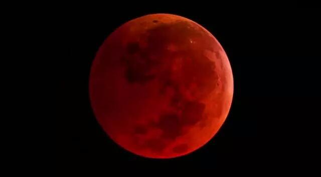
Lunar Eclipse Visible From Dubai!
Wow.

where?
Middle East.
hmmmmmm
During NEM it will be like this in pondy
hope you post those moments in this NEM
Yes
This is sand storm
Cumulus Photography!

What A Towering!

Towering of clouds are possible in desert. But rain will not be there.
Eclipse! Visible.

mesmerizing
sai photo time going on
Lol… Blog so dull.
Perfect Picture Of Eclipse.
Where will all the TS in interior goes
kerala and karnataka
Winds not at all favourable for chennai to get any rain
What about pondy
Once winds change to nw pondy has wonderful chance